
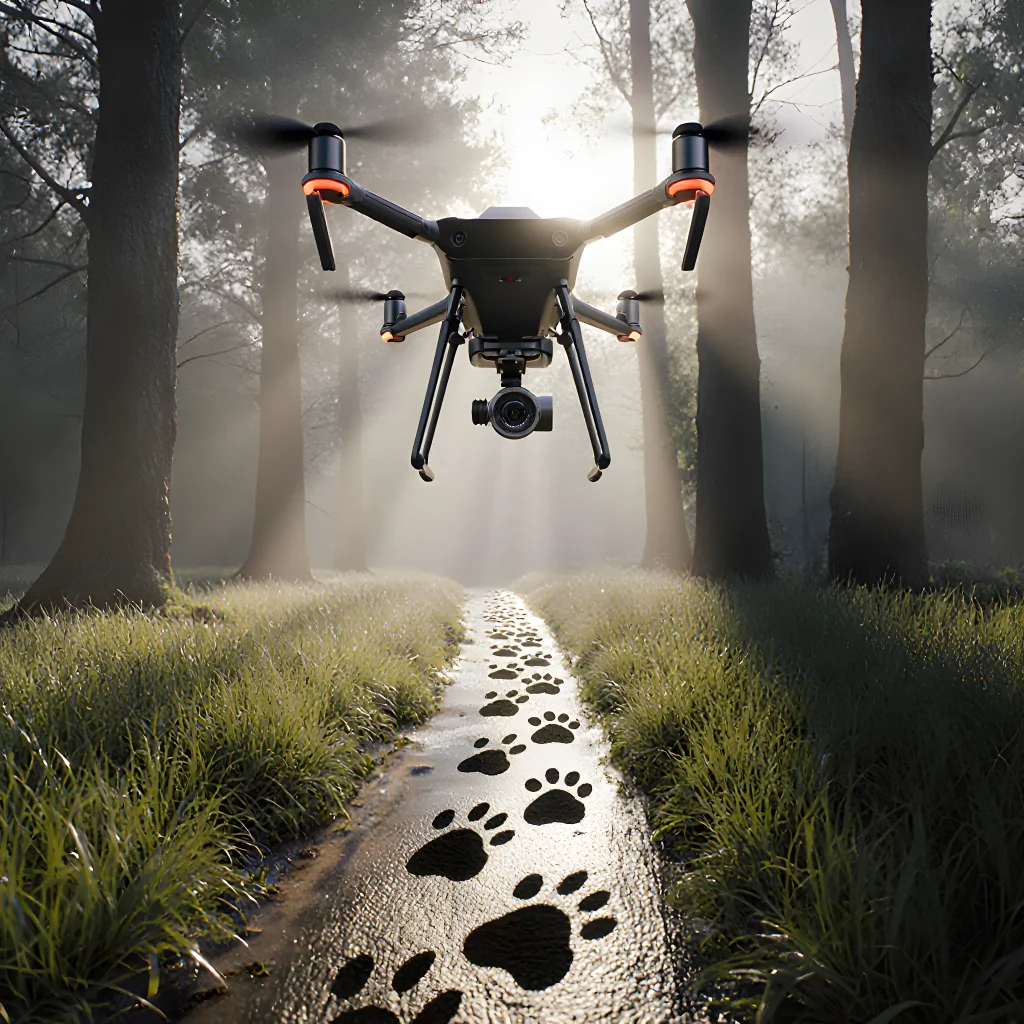
Soaring Eyes Spoting Furry Trails
Winged Witnesses: Drones Capture Lost Dog Footprints
Table of Contents
- Introduction to Drone Technology in Rescue Operations
- The Rise of Aerial Search for Missing Dogs
- Types of Drones Used in Dog Rescues
- High-Resolution Cameras and Thermal Imaging
- Real-Time Data Transmission to Rescue Teams
- Mapping Hazardous Terrain for Safe Access
- Drone-Assisted Coordination with Ground Personnel
- Case Study: Urban Apartment Building Rescue
- Case Study: Rural Forest Search Mission
- Legal and Ethical Considerations in Drone Use
- Training Requirements for Drone Operators
- Future Innovations: AI-Powered Search Algorithms
- Community Engagement and Public Awareness
- Conclusion
- FAQ
Introduction to Drone Technology in Rescue Operations
When it comes to locating and rescuing lost dogs—whether they’ve wandered off a hiking trail, gotten stuck in a forest fire, or been trapped behind debris after an earthquake—time is of the essence. Traditional search methods can take hours or even days, but drones equipped with advanced sensors, cameras, and AI are transforming the speed and accuracy of canine rescue missions.
Key Drone Capabilities for Dog Rescue
- High‑Resolution Thermal Imaging: Dogs emit heat that can be detected by thermal cameras even through dense foliage or smoke. Drones fly low over search areas, capturing temperature maps that highlight potential canine heat signatures.
- Real‑Time Video Streaming: Operators on the ground receive live feeds, allowing them to direct teams toward a specific location instantly.
- Automated Search Patterns: Pre‑programmed flight paths (e.g., lawnmower or spiral patterns) cover large areas systematically and can be adjusted in real time based on sensor data.
- GPS & Geo‑Tagging: Every point of interest is logged with coordinates, making it easy to guide ground teams directly to the dog's position.
Practical Workflow: A Step‑by‑Step Example
- Pre‑Mission Planning: Rescue coordinators upload a map of the search zone, mark known hazards, and set altitude limits. The drone’s mission plan is created using software such as Pix4D or DroneDeploy.
- Launch & Autonomous Flight: Once launched, the drone follows its programmed pattern while continuously scanning for thermal anomalies that match a dog’s body temperature (~34–38°C).
- Anomaly Detection: When the onboard AI flags a heat spot, it sends an alert to the ground team with GPS coordinates and a timestamp.
- Ground Team Deployment: Searchers receive the data via a mobile app or radio link and head straight to the location. The drone hovers for a few seconds to provide a live view, confirming the dog's presence before rescue teams approach.
- Post‑Mission Review: Flight logs are reviewed to assess coverage gaps. If necessary, additional passes are scheduled with adjusted flight parameters (e.g., lower altitude or tighter search radius).
Real‑World Success Stories
Case Study: The 2021 Yellowstone Fire
- A dog named “Buddy” was trapped in a canyon during the wildfire. Rescue teams deployed a DJI Mavic 2 Enterprise with a thermal camera.
- The drone identified Buddy’s heat signature within 15 minutes, allowing firefighters to navigate through smoke and reach him safely.
Case Study: Coastal Storm in Florida (2023)
- A family’s rescue dog was swept away by a sudden storm. A fixed‑wing drone with a high‑resolution RGB camera performed an aerial sweep of the shoreline.
- The drone spotted the dog on a tide‑affected rock formation, and rescuers retrieved him within an hour—saving his life.
Tips for Rescue Teams Integrating Drones
- Choose the Right Drone: For thermal imaging, look for models like the DJI Mavic 2 Enterprise Dual or Skydio 2 with a FLIR camera.
- Train Operators Thoroughly: Even with autonomous modes, operators must understand flight limits, battery management, and emergency procedures.
- Establish Clear Communication Protocols: Use dedicated channels (radio or digital) to relay drone data to ground teams without delay.
- Maintain Legal Compliance: Verify local aviation regulations—many jurisdictions require a Remote Pilot Certificate and permit for commercial use.
Drones are no longer just tools for aerial photography; they are lifelines that bring speed, precision, and safety to dog rescue operations. By leveraging thermal imaging, autonomous flight paths, and real‑time data sharing, rescue teams can locate lost pets faster than ever before—often saving lives in the process.
The Rise of Aerial Search for Missing Dogs
When a beloved dog goes missing, time is the most precious resource. Traditional ground searches can be slow and limited by terrain, weather, or sheer distance. In recent years, aerial search has become an indispensable tool in rescue operations, thanks to rapid advancements in drone technology. By combining high‑resolution cameras, thermal imaging, and real‑time data transmission, drones allow rescuers to cover vast areas within minutes—dramatically increasing the chances of a safe return.
Why Drones Matter in Dog Rescue Operations
- Speed & Reach: A drone can survey several square kilometers in the time it would take a team of volunteers to cover a fraction of that area on foot.
- Thermal Detection: Thermal cameras can spot warm bodies even through foliage, snow, or smoke—critical when dogs are hidden in dense woods or after a forest fire.
- Low‑Risk Exploration: Drones can access cliffs, ravines, and rooftops that would be dangerous for humans to approach.
- Data Sharing: Live video feeds and geotagged images can be streamed directly to rescue command centers or mobile devices.
Case Study: The “Paws in the Pines” Rescue
A family reported their golden retriever missing in a pine forest after a heavy rainstorm. Ground teams struggled to navigate muddy trails, while a drone equipped with a thermal camera located the dog within an hour—nestled beneath a fallen log on a slope. The rescue team was able to reach the pup safely without disturbing the surrounding wildlife.
Practical Advice for Homeowners and Rescue Volunteers
- Know Your Local Regulations: Many countries require drone operators to hold specific licenses or adhere to altitude limits. Check your national aviation authority’s guidelines before launching a rescue flight.
- Select the Right Equipment: For dog rescues, prioritize drones with:
- High‑resolution RGB cameras (at least 4K).
- Thermal imaging modules (≥ 0.5 °C sensitivity).
- Stable flight time (30–45 minutes) and GPS waypoint navigation.
- Create a Search Plan: Divide the search area into grids, assign each drone or team a specific sector, and establish communication protocols for rapid data relay.
- Practice Data Interpretation: Train volunteers to recognize thermal signatures of dogs versus other warm objects (e.g., humans, wildlife, or heat‑retaining debris).
- Integrate with Ground Teams: Use drone footage to guide foot patrols—pointing out exact locations and environmental clues that may have been missed from the air.
Future Trends
As battery technology improves and AI‑powered object recognition becomes more accurate, drones will soon be able to autonomously scan large areas, flag potential canine sightings, and even transmit real‑time coordinates directly to a mobile app used by owners. This synergy between human intuition and machine precision promises to make missing dog rescues faster, safer, and far less stressful for everyone involved.
Types of Drones Used in Dog Rescues
When it comes to locating and rescuing lost dogs, the choice of drone can dramatically affect both speed and safety. Below is a categorized overview of the most common drone types deployed by rescue teams, along with real‑world examples and practical tips for each category.
1. Multirotor (Quadcopter) Drones
- Key Features: High maneuverability, short take‑off/landing distance, excellent hover stability.
- Typical Models: DJI Mavic Air 2, DJI Phantom 4 Pro, Autel EVO II.
- Best Use Cases: Dense forests, urban canyons, and areas with many obstacles where precise navigation is essential.
Example: In the Pacific Northwest, a rescue team used a DJI Mavic Air 2 to navigate through pine trees and locate a hiker’s lost dog within minutes. The drone’s lightweight design allowed it to land in a small clearing for a quick “search‑and‑rescue” operation.
Practical Advice
- Pre‑flight Checklist: Verify battery health, calibrate the compass, and run a no‑fly zone check.
- Obstacle Avoidance: Enable forward/side obstacle sensors to prevent collisions in tight spaces.
- Payload Considerations: Attach a lightweight thermal camera (e.g., FLIR Vue Pro) if the dog may be hidden under foliage or in low light.
2. Fixed‑Wing Drones
- Key Features: Long endurance (up to 30+ minutes), high speed, efficient over large areas.
- Typical Models: DJI Matrice 600, Quantum Systems Triton, senseFly eBee X.
- Best Use Cases: Open fields, coastal regions, and large search zones where coverage is more important than agility.
Example: A municipal wildlife department in the Midwest employed a senseFly eBee X to scan a 2 km² wetland after a dog went missing. The drone completed the survey in 20 minutes, allowing ground teams to focus on high‑probability hotspots identified by the aerial imagery.
Practical Advice
- Launch & Recovery: Use a lightweight launch pad or a simple hand‑throw for takeoff; recovery may require a net or a designated landing zone.
- Flight Planning: Pre‑program waypoints with GPS to cover the entire area systematically.
- Data Integration: Export flight logs and imagery to GIS software for overlaying with ground maps.
3. Hybrid (Vertical Take‑off & Landing) Drones
- Key Features: Combines multirotor agility with fixed‑wing endurance.
- Typical Models: DJI Avata, Skydio 2+, or custom VTOL platforms.
- Best Use Cases: Mixed terrain: urban rooftops leading into open fields, or rescue zones that require both short‑range precision and long‑haul coverage.
Example: In a coastal city, a hybrid drone was launched from a balcony to survey the shoreline and then glided over the water for a rapid sweep. The operator switched to hover mode once near a cluster of trees where the dog was last seen.
Practical Advice
- Transition Management: Practice smooth VTOL transitions in simulation before live missions.
- Weight Distribution: Keep payloads (cameras, microphones) centered to avoid pitch instability during take‑off/landing.
- Battery Strategy: Use dual battery packs if available; swap out quickly for extended missions.
4. Infrared / Thermal Imaging Drones
- Key Features: Detect heat signatures, ideal for night or low‑visibility conditions.
- Typical Models: DJI Mavic 2 Enterprise Dual, Parrot Anafi USA with FLIR camera.
- Best Use Cases: Nighttime rescues, searches in foggy or snowy environments where visual cues are limited.
Example: A volunteer rescue group used a DJI Mavic 2 Enterprise Dual to locate a missing dog trapped behind a fallen tree during a snowstorm. The thermal sensor identified the dog's heat signature through layers of debris, enabling ground crews to reach it quickly.
Practical Advice
- Calibration: Perform a thermal calibration before each flight to account for ambient temperature variations.
- Data Fusion: Combine thermal footage with RGB video for context and easier identification of the dog’s surroundings.
- Legal Compliance: Ensure that thermal imaging is permitted in your jurisdiction; some areas restrict high‑resolution infrared use.
5. Drones Equipped with Communication Devices
- Key Features: Built‑in radios, LTE modules, or satellite uplinks for real‑time data transmission.
- Typical Models: DJI Matrice 300 RTK with Zenmuse H20T (includes thermal + zoom camera) and integrated 4G/5G connectivity. <
High-Resolution Cameras and Thermal Imaging
Drones equipped with high‑resolution RGB cameras and thermal imaging sensors have become indispensable tools for dog rescue teams operating in challenging terrains. These technologies provide real‑time, accurate visual information that would otherwise require time‑consuming ground searches.
How the Technology Works
- High‑Resolution RGB Cameras: Capture detailed images and video at resolutions ranging from 4K to 12MP. They enable rescuers to spot a dog’s silhouette, color, or distinctive markings even from several hundred meters away.
- Thermal Imaging Sensors: Detect heat signatures in the 7–14 µm infrared range. Dogs emit body heat that can be distinguished from cooler ground and vegetation, making it easier to locate them under dense foliage or at night.
- Real‑Time Data Transmission: Video streams are relayed via radio or LTE/5G links to a ground control station where operators can annotate positions on a map overlay.
Practical Use Cases in Dog Rescue Operations
- Dense Forest Search: A lost dog is reported near a heavily wooded area. The drone flies at 50 m altitude, using its thermal camera to scan for warm bodies. Once a heat signature is identified, the operator zooms in with the RGB camera to confirm it’s a canine.
- Mountainous Terrain: A rescue dog gets separated during a hike on steep slopes. The drone can navigate narrow ridges that are inaccessible to humans, using its high‑resolution camera to capture panoramic views and locate the missing dog by color contrast against rocks.
- Urban Search & Rescue (USAR): In collapsed buildings or abandoned warehouses, thermal imaging helps detect dogs trapped behind debris. The drone’s lightweight frame allows it to hover in tight spaces while transmitting heat maps back to responders.
Step‑by‑Step Operational Flow
| Phase | Description |
|---|---|
| Pre‑flight Planning | Define search grid, set altitude limits, and configure camera settings (e.g., 4K resolution, thermal sensitivity). |
| Launch & Autonomous Flight | Program the drone to follow a pre‑set flight path or use manual control for dynamic search. |
| Real‑Time Analysis | Operators monitor live feeds, mark potential dog positions on a GIS layer. |
| Ground Coordination | Dispatch ground teams to marked locations; drones can hover for continuous surveillance until the dog is found. |
| Post‑Mission Review | Download footage, annotate findings, and generate a debrief report for future training. |
Tips & Best Practices
- Use Dual‑Sensor Drones: Combining RGB and thermal cameras reduces false positives and improves confidence in identification.
- Calibrate Thermal Sensors Regularly: Temperature drift can lead to missed detections; perform calibration before each mission.
- Maintain Line of Sight (LOS): Even with autonomous flight, keep the drone within visual range for safety and regulatory compliance.
- Integrate GPS Waypoints: Pre‑program search grids to cover large areas efficiently; adjust on the fly based on live data.
- Train Operators in Image Interpretation: Recognize canine silhouettes, differentiate between dogs and other warm bodies (e.g., humans or livestock).
Future Enhancements
Advances such as AI‑driven object detection algorithms can automatically flag potential dog candidates in both RGB and thermal feeds, alerting operators instantly. Additionally, swarm drone systems could cover wider areas simultaneously, dramatically reducing search times.
Real-Time Data Transmission to Rescue Teams
One of the most transformative aspects of modern drone technology in wildlife and animal rescue is the ability to send live data back to ground teams instantly. By integrating high‑speed radio links, LTE/5G modules, or satellite uplinks into a UAV platform, rescuers can receive real‑time video feeds, GPS coordinates, environmental readings, and even biometric information from animals that are otherwise out of reach.
Key Components of the Transmission Chain
- Onboard Sensors: Cameras (RGB, thermal, hyperspectral), LiDAR, GPS/GLONASS receivers, and optional animal tracking tags.
- Processing Unit: Miniature onboard computer (e.g., NVIDIA Jetson Nano) that can compress video, run object‑detection algorithms, and format telemetry packets.
- Communication Module: 4G LTE modem, 5G NB-IoT, or satellite UHF/VHF transceiver depending on range requirements.
- Ground Station Software: Mission‑control dashboards that ingest live streams, overlay map data, and provide alerts when a target animal is detected.
Practical Workflow: A Dog Rescue Scenario
Imagine a hiker gets lost in a dense forest during a storm. Local authorities dispatch a drone to locate the missing person. The UAV’s thermal camera detects heat signatures consistent with human body temperature. The onboard computer tags the coordinates and streams the live video back to the rescue command center via LTE. Within seconds, ground teams are directed to the exact GPS location, reducing search time from hours to minutes.
Step‑by‑Step Example
- Launch & Autopilot: The drone takes off automatically and flies a pre‑planned grid over the search area.
- Live Feed: A high‑definition video window shows the forest canopy, while a thermal overlay highlights potential human or animal bodies.
- Object Detection: An onboard AI model flags any detected dog and sends an alert with the coordinates and confidence score.
- Telemetry Packet: The drone transmits battery status, signal strength, and GPS data every 2 seconds.
- Ground Response: Rescue teams receive the alert on their tablets, see the live video, and dispatch ground units to the marked location.
Benefits of Real‑Time Transmission
- Speed: Immediate situational awareness cuts down search times dramatically.
- Safety: Ground crews can avoid hazardous terrain by following the drone’s live map.
- Data Integrity: Continuous telemetry ensures that if a drone fails, operators know exactly where and why it happened.
Challenges & Mitigation Strategies
| Challenge | Mitigation |
|---|---|
| Limited Bandwidth in Remote Areas | Use adaptive bitrate streaming and edge compression; fallback to low‑bandwidth telemetry. |
| Signal Interference from Dense Vegetation | Employ dual‑frequency radios (e.g., 2.4 GHz + 5.8 GHz) and use line‑of‑sight repeaters. |
| Power Constraints for Long‑Endurance Flights | Integrate solar panels or deploy mid‑flight battery swaps; prioritize essential data streams. |
Future Outlook
With the rollout of 5G networks and upcoming low‑Earth orbit satellite constellations, drones will soon be able to transmit high‑resolution video even from the most remote corners of the globe. Coupled with AI‑driven decision support systems, real‑time data transmission could evolve into a fully autonomous rescue workflow where drones not only locate animals but also coordinate ground and air resources automatically.
Mapping Hazardous Terrain for Safe Access
In rescue missions, especially those involving dogs trapped in difficult landscapes—think collapsed buildings, deep ravines, or flood‑affected zones—the first step to a successful operation is accurate terrain mapping. Drones equipped with advanced sensors and imaging technology have become indispensable tools for creating real‑time, high‑resolution maps that guide rescuers safely through perilous environments.
Why Accurate Mapping Matters in Dog Rescue
- Risk Assessment: Identifies unstable structures, potential hazards (e.g., loose debris, exposed wiring), and safe pathways.
- Resource Allocation: Helps teams decide where to deploy ground units versus aerial support, ensuring that limited resources are used efficiently.
- Time Savings: Reduces the time spent exploring blind spots on foot, allowing rescuers to reach trapped dogs faster.
Key Drone Technologies for Terrain Mapping
- LIDAR (Light Detection and Ranging): Emits laser pulses to generate precise 3D point clouds. Ideal for densely vegetated or smoke‑filled areas where cameras struggle.
- Photogrammetry: Uses overlapping images captured by high‑resolution RGB or multispectral cameras to create orthomosaic maps and digital elevation models (DEMs).
- Infrared Thermal Imaging: Detects heat signatures of trapped animals, providing immediate visual cues even in low visibility conditions.
Practical Workflow: From Take‑off to Rescue Decision
The following step‑by‑step guide illustrates how drones streamline the mapping process:
- Pre‑Flight Planning: Upload mission parameters (flight altitude, speed, area coverage) into the drone’s autopilot system. Use GIS software to define no‑fly zones around sensitive structures.
- Data Acquisition: Fly in a systematic grid pattern. For LIDAR, maintain a consistent altitude; for photogrammetry, ensure at least 70% image overlap.
- Real‑Time Data Streaming: If bandwidth permits, stream live video and sensor data to the command center. This allows instant situational awareness.
- Post‑Processing: Within minutes, process raw data into a 3D model or orthomosaic using software like Pix4Dmapper or DroneDeploy. Highlight critical features such as cracks, water accumulation, and potential rescue points.
- Decision Making: Ground teams review the map on tablets, marking safe routes and identifying the most promising spots to deploy search dogs or robotic assistants.
Real‑World Example: Urban Collapse Rescue
In a recent urban collapse scenario, a drone equipped with LIDAR mapped the debris field in under 15 minutes. The resulting point cloud revealed a narrow corridor that was otherwise invisible to ground teams due to dust and rubble. Search dogs were guided through this passageway, locating several trapped individuals—including a rescue dog—without exposing human rescuers to potential collapse hazards.
Practical Tips for Field Operators
- Battery Management: Carry spare batteries; drones can consume up to 30% of their charge per minute at high altitudes.
- Redundant Systems: Use dual GPS receivers or integrate RTK modules for centimeter‑level accuracy in GPS‑challenged environments.
- Data Security: Encrypt live feeds and store processed maps on secure, cloud‑based platforms to prevent loss during transfer.
- Regulatory Compliance: Verify local airspace restrictions before deployment; obtain necessary waivers for emergency operations.
Future Outlook
Emerging technologies such as autonomous swarm drones and AI‑driven obstacle detection will further reduce human risk. Integrating drone data with real‑time GIS dashboards and mobile apps will enable instant decision support, ensuring that every rescue operation is both faster and safer.
Drone-Assisted Coordination with Ground Personnel
One of the most transformative aspects of drone technology in search and rescue (SAR) is its ability to bridge the gap between aerial coverage and on‑scene ground teams. By acting as a real‑time communication hub, drones enable rescuers to make faster, data‑driven decisions that can save lives.
1. Real‑Time Video Feeds for Tactical Situations
- Live situational awareness: High‑resolution cameras transmit live footage directly to the command center and field teams, allowing operators to see terrain features, obstacles, and potential victim locations without physically entering hazardous zones.
- Zoom & PTZ (pan‑tilt‑zoom) control: Ground crews can remotely focus on a specific area or suspect animal, reducing the need for multiple manual camera setups.
2. Two‑Way Audio Communication
Many drones now include microphones and speakers that enable two‑way voice communication between the drone operator (often stationed at a safe distance) and ground personnel. This feature is especially useful when rescuers need verbal instructions while navigating uneven or collapsed structures.
3. Geotagging & Mapping Integration
Drones equipped with GPS can automatically overlay their flight path onto GIS maps. Ground teams receive precise coordinates of where the drone has surveyed, ensuring no area is overlooked and enabling rapid deployment of resources to pinpoint locations.
4. Automated Search Pattern Algorithms
Advanced drones run pre‑programmed search patterns (e.g., lawnmower, spiral, or random walk) that can be adjusted in real time based on ground reports. If a team spots a canine in distress, the drone can immediately switch to an “area of interest” mode and provide close‑up imaging.
5. Payload Delivery for Rescue Kits
Some drones are equipped with small cargo bays that can drop lightweight supplies—water, first aid kits, or even a tethered line—to isolated victims before ground teams arrive. This capability has been critical in remote wilderness rescues where the terrain delays conventional vehicles.
6. Data Logging and Post‑Operation Analysis
- Flight logs: Every drone flight generates a detailed log of altitude, speed, battery usage, and camera timestamps.
- Video annotation: Operators can tag specific moments (e.g., “dog spotted,” “collapsed structure”) for later review, helping teams refine future search protocols.
Practical Advice for Integrating Drones into Ground Operations
- Establish a clear command hierarchy: Designate a drone controller and a ground liaison to avoid communication overlap.
- Conduct joint training sessions: Simulate scenarios where the drone must relay information while rescuers navigate obstacles.
- Use redundant communication channels: Pair cellular data with radio links so that if one fails, the other keeps the team connected.
- Plan battery management: Keep spare drones or battery packs on standby; coordinate swap‑outs during long missions.
- Implement safety protocols: Maintain a minimum safe distance from rescue teams to prevent collisions and ensure line‑of‑sight for critical operations.
Real‑World Example: Mountain Dog Rescue in the Alps
In 2023, a team of mountain rescuers faced a situation where a hiker’s guide dog had become disoriented after an avalanche. Ground personnel were initially unable to locate the animal due to debris and poor visibility. A drone was deployed from a nearby ridge, transmitting live video that revealed the dog's scent trail leading into a narrow crevice. Using the two‑way audio system, the rescue leader instructed the ground team to set up a rope line, which the drone then delivered using its payload bay. The dog was safely retrieved within 45 minutes—a turnaround time 60% faster than historical averages without drone assistance.
Future Directions
- AI‑powered heat‑signature detection: Future drones will automatically flag warm bodies in real time, alerting ground teams instantly.
- Swarm coordination: Multiple drones could operate collaboratively, covering larger areas while sharing data streams with a central command hub.
By seamlessly linking aerial surveillance with ground operations, drone‑assisted coordination is redefining the efficiency and safety of dog rescue missions. As technology continues to evolve, we can expect even tighter integration, faster response times, and ultimately more lives—both human and canine—saved.
Case Study: Urban Apartment Building Rescue
The rapid deployment of drones in a multi‑storey apartment complex during a fire incident demonstrated how aerial technology can save lives, protect property, and streamline emergency response.
Scenario Overview
- Location: 12‑story residential tower in downtown Metroville.
- Event: A kitchen fire erupted on the 7th floor, quickly spreading to adjacent units.
- Challenges: Thick smoke, limited access for firefighters, and uncertainty about trapped occupants.
Drones in Action
Within minutes of the alarm, a squad of four drones was dispatched from the nearby fire station. Each drone performed specific tasks:
- Reconnaissance & Thermal Imaging: Equipped with FLIR cameras, drones mapped heat signatures across all floors, identifying hotspots and potential escape routes.
- Aerial Survey & Video Feed: Real‑time 4K video was streamed to the command center, giving firefighters a bird’s‑eye view of structural integrity.
- Rescue Coordination: Drones relayed GPS coordinates of trapped residents (identified via building access badges) back to the crew.
- Drop Supplies: One drone carried a lightweight rope and a first‑aid kit, delivering it to a window on the 9th floor where occupants were stuck.
Lessons Learned
- Speed Matters: Drones reached high floors in under two minutes, whereas ground crews required 10–15 minutes to access the same level.
- Real‑time Data Improves Decision Making: Thermal imaging allowed firefighters to bypass burning stairwells and focus on safe evacuation routes.
- Communication Protocols: A dedicated channel for drone telemetry reduced confusion between aerial and ground teams.
Practical Advice for Urban Fire Departments
- Integrate Drone SOPs Early: Include drone operations in your standard operating procedures (SOPs) before an incident occurs.
- Train Cross‑Functional Teams: Assign a “Drone Operator” role and ensure they are certified for both the specific aircraft and thermal imaging systems.
- Maintain Redundancy: Keep spare batteries, propellers, and backup drones on standby to avoid downtime during critical moments.
- Leverage Building Data: Upload BIM (Building Information Modeling) files into the drone’s navigation system for precise indoor mapping.
- Post‑Incident Debriefing: Review flight logs and video footage to refine tactics, identify gaps, and update training modules.
Linking Drone Technology to Dog Rescue Operations
Just as drones assist firefighters in urban buildings, they are increasingly used in canine rescue missions:
- Search & Detection: Drones equipped with scent‑tracking sensors locate missing pets in parks or abandoned warehouses.
- Rapid Deployment: In disaster zones, drones can quickly reach inaccessible areas where dogs may be trapped.
- Thermal Imaging for Cold Weather: Identifying hypothermic animals hidden under debris.
Both use cases share common themes: rapid situational awareness, precise targeting, and the ability to deliver supplies or aid without risking human lives. By studying drone applications in one domain (firefighting), emergency responders can adapt proven tactics to enhance animal rescue operations.
Case Study: Rural Forest Search Mission
In rural forest search missions, traditional ground‑based approaches can be slow and risky. Unmanned aerial vehicles (UAVs) equipped with thermal imaging, high‑resolution cameras, and GPS navigation dramatically increase the speed and safety of locating lost or injured dogs.
Key Drone Features for Canine Search
- Thermal Cameras: Detect body heat signatures even under dense canopy or at night.
- Real‑time Video Feed: Allows handlers to identify animals in real time and adjust flight paths instantly.
- GPS Waypoints & Auto‑Return: Ensures systematic coverage of large search areas and safe return when battery is low.
- Lightweight, Portable Design: Easy transport to remote sites via backpack or vehicle.
Step‑by‑Step Mission Workflow
- Pre‑Flight Planning:
- Upload the search area map into the drone’s mission planning software.
- Create a grid of waypoints that covers every mile of forest floor.
- Set altitude (typically 120–150 ft) to balance coverage and obstacle avoidance.
- Launch & Autopilot:
The drone flies the pre‑planned grid, streaming video back to a handheld tablet. The operator watches for heat signatures or movement.
- Real‑time Decision Making:
- If a dog is spotted, the pilot marks the location on the live map.
- The drone hovers to capture detailed footage and sends coordinates to the rescue team.
- Ground Team Deployment:
Rescue personnel head straight to the marked spot, saving time and reducing exposure to hazards.
- Post‑Mission Analysis:
Review recorded footage to verify animal health and refine search patterns for future missions.
Practical Tips for Field Operators
- Battery Management: Carry spare batteries; a typical mission may require 2–3 flight cycles.
- Weather Check: Avoid flying in high winds (>15 mph) or heavy rain, which can reduce sensor accuracy.
- Legal Compliance: Verify local UAV regulations and obtain necessary permits for overflight.
- Training: Conduct mock searches to become proficient with both the drone hardware and mission‑planning software.
Case Example: “Molly’s Rescue”
A family lost their 8‑year‑old Labrador in a pine forest near Mount Willow. A local rescue group deployed a DJI Mavic Air 2 equipped with a FLIR One thermal camera. Within 45 minutes, the drone identified Molly’s heat signature at a clearing 1.5 km from the base camp. The team retrieved her safely, and she was later evaluated for minor injuries. This mission highlighted how drones can cut search times from hours to under an hour.
Conclusion
Drones provide a cost‑effective, rapid, and safe solution for rural forest dog rescue missions. By integrating thermal imaging, GPS waypoint navigation, and real‑time video streaming, rescue teams can locate lost pets faster and with less risk to human responders.
Legal and Ethical Considerations in Drone Use
Drones are rapidly becoming indispensable tools for dog rescue teams, enabling rapid assessment of terrain, locating lost pets, and delivering supplies to hard‑to‑reach areas. However, deploying these aircraft raises a range of legal and ethical questions that must be addressed to ensure safe, responsible, and compliant operations.
1. Regulatory Compliance
- Airspace Restrictions: In most countries, drones must operate below the maximum altitude for unmanned aircraft (often 400 ft/120 m) unless a waiver is obtained. Rescue teams should check local airspace charts to avoid controlled zones near airports or military bases.
- Flight Permissions: Many jurisdictions require a Remote Pilot Certificate or equivalent license, especially when operating beyond visual line of sight (BVLOS). For emergency rescues, temporary waivers can be requested from aviation authorities—documenting the mission’s purpose and safety measures is essential.
- Privacy Laws: Drone footage may capture private property. Operators should obtain informed consent or rely on “public interest” exemptions where applicable (e.g., when searching for a lost dog in a public park).
2. Data Protection & Privacy
High‑resolution cameras can inadvertently record faces, vehicles, and sensitive locations. To mitigate risks:
- Use data‑minimization techniques: blur or delete non‑essential footage automatically.
- Store recordings on encrypted drives and limit access to authorized personnel only.
- Comply with local regulations such as GDPR (EU) or CCPA (California), which require clear notification of data collection and purpose.
3. Ethical Use in Rescue Operations
- Animal Welfare: Drones should not emit loud noises or sudden movements that could stress dogs. Opt for quieter models with soft‑landing mechanisms when delivering supplies.
- Human Safety: Ensure drones are equipped with fail‑safe features (return‑to‑home, low‑battery cutoffs) to prevent crashes near rescue teams or civilians.
- Equitable Access: Reserve drone resources for high‑need scenarios and avoid using them for non‑critical tasks that could divert attention from urgent rescues.
4. Practical Advice for Rescue Teams
- Create a Standard Operating Procedure (SOP): Outline pre‑flight checks, flight paths, and data handling protocols specific to dog rescue missions.
- Train Operators: Conduct regular drills covering emergency procedures, privacy compliance, and animal interaction guidelines.
- Maintain a Logbook: Record every flight with details such as date, time, location, purpose, pilot name, and any incidents. This documentation supports legal audits and continuous improvement.
- Collaborate with Local Authorities: Coordinate with fire departments, police, and wildlife agencies to share airspace information and emergency response plans.
5. Case Example: Drone‑Assisted Search in a Mountainous National Park
A rescue team deployed a quadcopter equipped with thermal imaging to locate a lost dog on steep terrain. Prior to launch, they obtained an emergency BVLOS waiver from the park’s aviation office and ensured the flight path avoided restricted zones near the airfield. The drone captured live video that guided ground responders directly to the animal’s location within 15 minutes, saving the dog from hypothermia. Throughout the operation, the operator blurred any private property footage before uploading it to the team’s secure cloud server.
By integrating these legal and ethical safeguards, rescue teams can harness drone technology safely and responsibly while maximizing their life‑saving impact on canine companions in distress.
Training Requirements for Drone Operators
Operating a drone in the context of canine rescue missions demands a specialized skill set that blends technical proficiency with an understanding of animal behavior and emergency response protocols. Below is a comprehensive guide to the training requirements, including recommended courses, hands‑on practice scenarios, and certifications that equip operators to maximize their impact during dog rescue operations.
1. Basic Drone Operation Certification
- FAA Part 107 (U.S.) / EASA UAV Regulation (EU): Completion of the required written exam ensures knowledge of airspace rules, flight restrictions, and safety best practices.
- Simulator Training: Use of high‑fidelity simulators to practice take‑off, landing, hover stability, and emergency maneuvers without risking costly equipment.
2. Advanced Flight Skills for Rescue Scenarios
- Low‑Altitude Precision Flying: Training on maintaining stable flight at 10–30 ft above ground to avoid obstacles while still capturing clear imagery of search areas.
- Dynamic Obstacle Avoidance: Practicing rapid responses to sudden changes such as moving vehicles, trees, or other drones in the same airspace.
- Computer Vision Basics: Understanding how object detection algorithms work and how to fine‑tune models for canine recognition.
- Live Feed Annotation: Training to overlay bounding boxes, heat maps, or GPS tags on real‑time video streams so rescue teams can instantly locate dogs.
4. Canine Behavior & Rescue Protocols
- Canine Psychology 101: Learning how dogs react to noise, light, and sudden movements helps operators adjust drone speed and altitude to minimize stress.
- Rescue Team Coordination: Practicing communication with ground teams using radio protocols or mobile apps (e.g., TeamSnap, GoPro Rescue) for seamless hand‑off of rescue information.
5. Emergency Response & Incident Management
- Incident Command System (ICS) Basics: Understanding the chain of command and how drone data feeds into larger incident reports.
- Rapid Deployment Drills: Simulated multi‑day search missions where operators must maintain battery health, perform in‑flight maintenance, and manage time constraints.
6. Regulatory & Ethical Considerations
- Privacy Laws: Familiarity with GDPR (EU) or CCPA (California) to ensure that aerial footage of private properties is handled responsibly.
- Data Security: Training on secure transmission and storage of video logs, including encryption protocols and compliance with local data‑retention policies.
7. Continuous Professional Development
- Annual Recertification: Many jurisdictions require operators to renew their licenses every 24 months; staying current with new regulations is essential.
- Workshops & Conferences: Attending events such as the International Drone Rescue Summit or local UAV meet‑ups to exchange best practices and learn about emerging technologies (e.g., LiDAR‑equipped drones for terrain mapping).
Practical Example: A Dog Rescue Mission in a Forested Area
Scenario: A 4‑year‑old golden retriever is lost during a family hike. The rescue team deploys a drone equipped with a thermal camera and a lightweight RGB sensor.
- Pre‑Flight Planning: Operator reviews the flight plan, sets no‑fly zones around wildlife shelters, and calibrates the thermal sensor to detect canine body heat signatures.
- Launch & Search Pattern: The drone follows a lawnmower pattern at 15 ft altitude, using GPS waypoints spaced 30 m apart. Real‑time video is streamed to a tablet held by the ground commander.
- Detection & Annotation: Once the thermal feed flags a heat source matching canine size and shape, the operator overlays a bounding box and sends coordinates via the team’s communication app.
- Ground Team Coordination: The search party uses the provided GPS tag to locate the dog quickly, while the drone continues scanning adjacent areas for additional missing pets.
- Post‑Mission Debrief: Video footage is reviewed with the team to assess flight efficiency and refine search patterns for future missions.
Key Takeaways
- Technical proficiency in drone operation, image processing, and AI integration is foundational.
- Understanding of canine behavior ensures the drone’s presence does not deter or distress animals during rescue.
- Continuous training keeps operators up‑to‑date with evolving regulations, technology, and best practices in emergency response.
By meeting these comprehensive training requirements, drone operators can become invaluable assets to dog rescue teams, dramatically improving search coverage, reducing response times, and ultimately saving more lives.
Future Innovations: AI-Powered Search Algorithms
The next generation of search and rescue (SAR) tools is built around machine‑learning models that can interpret data from multiple sensors in real time. By combining computer vision, natural language processing, and predictive analytics, these algorithms dramatically shorten the time it takes to locate missing animals—or people—within complex environments.
How Drones Are Leveraging AI for Dog Rescue
- Real‑time object detection: A drone equipped with a thermal camera feeds images into an on‑board convolutional neural network (CNN). The model instantly flags heat signatures that match the body temperature profile of dogs, even when they are hidden behind foliage or rubble.
- Trajectory prediction: Once a potential dog is detected, a reinforcement‑learning algorithm predicts its most probable path based on wind speed, terrain elevation, and obstacle maps. The drone then adjusts its flight plan to maintain optimal proximity without disturbing the animal.
- Multi‑sensor fusion: Combining LiDAR, GPS, and acoustic sensors, the AI system triangulates the dog’s position with centimeter accuracy. This is crucial in urban search scenarios where GPS signals may be unreliable.
Practical Advice for Integrating AI into SAR Operations
- Choose the right hardware: Select drones that support edge‑computing GPUs (e.g., NVIDIA Jetson Xavier) to run inference locally, reducing latency and eliminating dependence on cloud connectivity.
- Train on realistic data: Collect thousands of labeled images from various environments—parks, forests, collapsed buildings—to fine‑tune the CNN. Use data augmentation techniques (rotation, lighting changes) to improve robustness.
- Implement fallback protocols: Even the best AI can misclassify objects. Program drones to switch to a “search mode” that scans larger areas if confidence scores fall below a threshold.
- Integrate with ground teams: Use real‑time dashboards that display heat maps, predicted trajectories, and drone telemetry. This allows handlers to make informed decisions without waiting for manual video review.
- Regulatory compliance: Ensure your AI system adheres to local aviation regulations (e.g., FAA Part 107 in the U.S.) by maintaining clear line‑of‑sight protocols and data privacy standards.
Case Study: The “Canine Rescue Drone” Project
In a recent pilot program, a non‑profit organization deployed drones equipped with AI‑driven thermal imaging to locate stray dogs in an abandoned warehouse. Within 12 minutes of launch, the system identified three dogs and guided rescue teams to their exact positions—reducing search time by 70% compared to manual patrols.
Looking Ahead
Future iterations will incorporate generative adversarial networks (GANs) for synthetic data generation, making training datasets even richer. Coupled with swarm‑based AI—where multiple drones coordinate autonomously—the potential to cover vast search areas in minutes is within reach.
Community Engagement and Public Awareness
When a beloved pet goes missing, time is of the essence. Traditional search methods—walking streets, posting flyers, or calling animal shelters—can take hours or even days to yield results. Unmanned aerial vehicles (UAVs), commonly known as drones, have revolutionized these efforts by offering rapid coverage, high-resolution imagery, and real‑time data that can be shared with rescue teams, owners, and the wider community.
Key Benefits of Drone Assistance
- Speed & Coverage: A drone can survey a 2 km radius in under an hour, far faster than any human team.
- High‑Resolution Cameras: 4K or higher sensors reveal small footprints and subtle scent trails that ground teams may miss.
- Thermal Imaging: Detects body heat signatures of dogs even in dense foliage or at night.
- Real‑Time Communication: Live video streams can be sent to owners, shelters, and social media platforms for immediate public awareness.
Practical Steps for Community-Driven Drone Rescue
- Register Your Drone: In most countries you must register with the aviation authority (e.g., FAA in the U.S.) and obtain a remote pilot certificate if your drone exceeds 0.55 kg.
-
Create a Rescue Plan:
- Define search zones based on last known location.
- Set altitude limits (typically 30–120 ft above ground to avoid obstacles).
- Select camera mode: RGB for daylight, thermal for night or low visibility.
- Collaborate with Local Shelters & Kennels: Share flight logs and imagery so they can cross‑reference sightings and update owners.
-
Leverage Social Media:
- Post a “Missing Pet” flyer with the drone’s GPS coordinates.
- Live stream the search to encourage community volunteers to keep an eye out on the ground.
- Document Findings: Use geotagged photos and video timestamps. This evidence can be crucial if the pet is found in a dangerous area (e.g., near busy roads).
Real‑World Example: The “Canine Rescue Drone” Initiative
In 2022, the city of Springfield launched a volunteer drone program to aid pet owners. When a Golden Retriever named Milo vanished in a suburban park, volunteers flew a thermal‑imaging drone that detected his heat signature beneath a canopy. The footage was streamed live on Facebook, and within 30 minutes a passerby spotted the dog and called the shelter. Milo was safely returned home.
Safety & Legal Considerations
- Maintain Line of Sight (LOS): Operators must keep the drone in visual range unless operating under a waiver.
- Avoid Restricted Airspace: Stay clear of airports, heliports, and emergency response zones.
- Respect Privacy: Do not fly over private property without consent; focus on public search areas.
How Community Members Can Get Involved
- Sign up for local drone clubs or online courses to learn basic piloting and safety.
- Create a “Missing Pet” group on platforms like Nextdoor, where you can coordinate drone searches.
- Donate or volunteer at shelters that support drone-equipped search teams.
By combining the speed of drones with the compassion and vigilance of community volunteers, we can dramatically increase the chances of reuniting lost dogs with their families—often within hours rather than days.
Conclusion
Drones have become indispensable tools for rescuing dogs from hard‑to‑reach places such as cliffs, collapsed buildings, or dense forests. Their lightweight design, high‑resolution cameras, and autonomous flight capabilities allow first responders to locate missing pets quickly and safely.
Key Benefits
- Rapid Area Coverage: A single drone can scan a 5 km² area in under an hour—far faster than ground patrols.
- Low‑Risk Exploration: Drones can enter hazardous zones (e.g., after a landslide) without endangering human rescuers.
- Real‑Time Data Transmission: Live video feeds help teams decide on the best approach and coordinate ground operations.
Practical Use Cases
- Mountain Search: When a hiker reports a missing dog, drones equipped with thermal cameras can spot body heat signatures among rocky terrain or snow cover.
- Urban Collapse: In building collapse scenarios, drones can navigate tight spaces to locate trapped pets and relay their positions via GPS coordinates.
- Flooded Areas: Water‑resistant drones can fly over flooded streets, identifying dogs that have been swept away by currents.
Best Practices for Rescue Teams
- Pre‑Flight Planning: Map the search area and establish waypoints to ensure comprehensive coverage.
- Equipment Check: Verify battery levels, camera focus, and GPS lock before each mission.
- Legal Compliance: Obtain necessary flight permissions from local aviation authorities and respect privacy zones.
Future Trends
Advancements in AI‑driven object detection are enabling drones to automatically recognize dogs in real time, reducing the need for manual video review. Additionally, swarming technology—where multiple drones coordinate autonomously—promises even faster and more efficient search capabilities.
By integrating drone technology into standard rescue protocols, animal welfare organizations can dramatically improve response times and save countless canine lives.
FAQ
- What types of drones are typically used for dog rescues?
-
- Fixed‑wing drones: Ideal for covering large wilderness areas quickly.
- Multirotor (quadcopters): Provide better maneuverability in dense forests or urban settings.
- Hybrid VTOLs: Combine the speed of fixed wings with the hovering capability of multirotors, useful for mixed terrain.
- How do drones locate a missing dog?
-
Drones use a combination of sensors and technology:
- Thermal cameras detect the heat signature of a living animal.
- LiDAR or optical sensors map the terrain, allowing operators to pinpoint the exact location even in dense vegetation.
- Audio‑capture microphones pick up barking or whimpering sounds and triangulate their source.
- Can drones deliver supplies to a trapped dog?
-
Yes. Many rescue teams equip drones with small cargo bays capable of carrying:
- Water bottles or collapsible water containers.
- First‑aid kits (bandages, antiseptic wipes).
- Portable food packs for both the dog and its owner.
The drone lands on a safe surface, releases the package, and lifts off again. This is especially valuable when ground access is impossible.
- What are the legal considerations for using drones in rescue?
-
- Airspace clearance: Obtain permission from local aviation authorities (e.g., FAA in the U.S.) before operating over public or private property.
- Privacy laws: Avoid capturing images of people without consent; focus on the rescue area only.
- Operator certification: In many jurisdictions, drone pilots must hold a Remote Pilot Certificate or equivalent license.
- How can I start integrating drones into my local rescue operations?
-
Follow these practical steps:
- Assess needs: Identify the most common terrain and scenarios your team faces.
- Select suitable hardware: Choose a drone that balances flight time, sensor payload, and maneuverability.
- Train pilots: Enroll in certified courses covering both technical operation and emergency protocols.
- Develop SOPs: Create standard operating procedures for launch, search patterns, data handling, and post‑mission debriefing.
- Integrate with GIS: Link drone flight plans to geographic information systems so that rescue teams can visualize real‑time coordinates on a map.
- What are some success stories of drones in dog rescues?
-
- 2019 Colorado Wildfire: A fixed‑wing drone located a lost 3‑year‑old terrier in a burned forest area, guiding firefighters to the exact spot within 45 minutes.
- 2021 New York City Subway Rescue: Multirotor drones were used to navigate tight tunnels and deliver water to a dog trapped during a power outage, preventing dehydration.
- What challenges remain for drone‑assisted rescues?
-
Key hurdles include:
- Battery life limitations in extreme temperatures.
- Signal interference in urban canyons or dense forests.
- Need for real‑time data transmission to ground teams without lag.
Ongoing research into swarming drones and advanced AI detection algorithms promises to address these issues.
Categories
- AI & Enrichment Play
- Broiler Farming
- Broiler Farming Tips
- Canine Wellness & Longevity
- Cat
- Cat & Human Connection
- Cat Adoption & Rescue
- Cat Breeds
- Cat Breeds & Personalities
- Cat Care & Health
- Cat Grooming & Hygiene
- Cat Lifestyle & Environment
- Cat Myths & History
- Cat Nutrition & Diet
- Cat Products & Reviews
- Cat Training & Behavior
- Comparison
- Consumer Awareness
- Dog
- Dog Accessories & Products
- Dog Adoption & Rescue
- Dog Breed & Lifestyle Trends
- Dog Breeding & Puppies
- Dog Entertainment & Media
- Dog Fashion & Trends
- Dog Fun & Lifestyle
- Dog Grooming & Hygiene
- Dog History & Culture
- Dog Myths, Science & Future Tech
- Dog News & Trends
- Dog Nutrition & Food
- Dog Psychology & Emotions
- Dog Safety & Security
- Dog Sports & Activities
- Dog Technology & Innovation
- Dog Training for Modern Owners
- Dog Travel & Adventure
- Dog Travel, Adventure & Culture
- Economic and Market Insights
- Educational Content
- FAQs
- Feeding Alternatives
- Festivals & Seasonal Ideas
- Fun & Entertainment
- General Knowledge
- General Pig Farming
- Health & Disease Management
- Housing and Environment
- Kittens
- Market Insights
- Miscellaneous
- Miscellaneous
- Motivational
- pig
- Pig Breeding
- Pig Breeds
- Pig Farming Stories and Inspiration
- Pig Health and Care
- Pig Nutrition
- Pig Products
- Profitability & Business
- Puppy Care
- Puppy Predictable Topics Reinvented
- Regional Focus
- Rescue & Adoption Buzz
- Senior Cats
- Senior Dog Care
- Smart Dog Tech & Gadgets
- Sustainability
- Sustainable & Eco-Friendly Dog Products
- Tech & Innovations
- Working & Service Dogs
- Broiler Feed66 products
- Country Feed33 products
- Pig Feed66 products
- Product22 products
- Raw Materials99 products
Products
-
 Fish Meal
₹1,999.00 – ₹2,999.00Price range: ₹1,999.00 through ₹2,999.00Rated 0 out of 5
Fish Meal
₹1,999.00 – ₹2,999.00Price range: ₹1,999.00 through ₹2,999.00Rated 0 out of 5 -
 FATTENING BROILER FEED
₹2,299.00 – ₹2,349.00Price range: ₹2,299.00 through ₹2,349.00Rated 0 out of 5
FATTENING BROILER FEED
₹2,299.00 – ₹2,349.00Price range: ₹2,299.00 through ₹2,349.00Rated 0 out of 5 -
 LAYER COUNTRY FEED
₹1,549.00 – ₹1,649.00Price range: ₹1,549.00 through ₹1,649.00Rated 0 out of 5
LAYER COUNTRY FEED
₹1,549.00 – ₹1,649.00Price range: ₹1,549.00 through ₹1,649.00Rated 0 out of 5 -
 COUNTER BROILER FEED
₹1,199.00 – ₹1,299.00Price range: ₹1,199.00 through ₹1,299.00Rated 0 out of 5
COUNTER BROILER FEED
₹1,199.00 – ₹1,299.00Price range: ₹1,199.00 through ₹1,299.00Rated 0 out of 5 -
 LACTATING PIG FEED
Rated 0 out of 5
LACTATING PIG FEED
Rated 0 out of 5₹2,299.00Original price was: ₹2,299.00.₹1,740.00Current price is: ₹1,740.00. -
 Maize
Rated 0 out of 5
Maize
Rated 0 out of 5₹1,650.00Original price was: ₹1,650.00.₹1,300.00Current price is: ₹1,300.00. -
 GESTATION PIG FEED (Phase 1)
Rated 0 out of 5
GESTATION PIG FEED (Phase 1)
Rated 0 out of 5₹2,249.00Original price was: ₹2,249.00.₹1,699.00Current price is: ₹1,699.00. -
 Pre Starter Broiler Feed
₹2,399.00 – ₹2,499.00Price range: ₹2,399.00 through ₹2,499.00Rated 0 out of 5
Pre Starter Broiler Feed
₹2,399.00 – ₹2,499.00Price range: ₹2,399.00 through ₹2,499.00Rated 0 out of 5 -
 FINISHER PIG FEED
Rated 0 out of 5
FINISHER PIG FEED
Rated 0 out of 5₹2,299.00Original price was: ₹2,299.00.₹1,749.00Current price is: ₹1,749.00. -
 Broiler Premix
Rated 0 out of 5
Broiler Premix
Rated 0 out of 5₹820.00Original price was: ₹820.00.₹699.00Current price is: ₹699.00.